
Each month we gather crime reports from the three law enforcement agencies that serve our patrol area and count how many happened inside it. For context, we do the same for the neighborhoods around it.
By type of crime
- Crimes against persons include assaults and threats.
- Property crimes include burglary, theft, car prowls, vandalism and fraud.
- Crimes against society include drug, weapon and trespass offenses.
Last 12 months
Twelve-month totals are a steadier guide than any three months.
Quarter by quarter
Our patrol areaSurrounding neighborhoods
The areas we count
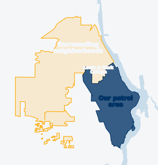
Our patrol area
Dunthorpe, Riverdale, Birdshill, and the Portland streets along Terwilliger Blvd that we patrol.
Sources:
Surrounding neighborhoods
Collins View, South Burlingame, Marshall Park, Arnold Creek, Lewis & Clark College, Tryon Creek State Park, and nearby unincorporated areas west of the river.
Sources:
About these numbers
- Counts are crimes reported to police, by the date they happened. One incident can include more than one crime, such as a break-in that also involves theft.
- We update this page monthly. Each month is added once Portland Police has published it twice, about seven weeks after the month ends, so late reports are included.
- If an agency corrects data we've already published, our numbers are corrected with the next update.
- "Per 1,000 homes" divides by the number of homes in each area (2020 Census housing units), so areas of different sizes can be compared.
- We never publish addresses. Some crimes are reported without an address to protect victims. When an agency still places one of these in a map area, we count it only if that area is inside the area being counted. Portland withholds the location entirely, so those reports can't be counted.
- Small numbers swing a lot from one period to the next. The 12-month totals are a steadier guide.
Questions about these numbers? Contact us.