
Each month we count the crimes reported to Portland Police in the two commercial areas we patrol along the river: John's Landing and South Waterfront. Each area is shown on its own.
The areas we count
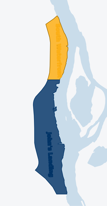
South Waterfront
The City of Portland's South Waterfront district, from the Marquam Bridge south to S Moody Ave, between I-5 and the river.
John's Landing
Along S Macadam Ave from S Moody Ave south to the Sellwood Bridge, between I-5 and the river, including docks and moorages.
Source: Portland Police Bureau open data.
About these numbers
- Counts are crimes reported to Portland Police, by the date they happened. One incident can include more than one crime.
- We count only what Portland releases. Portland withholds the location of many crimes against people, so those can't be placed in either area.
- Crimes on I-5 are left out.
- Police data can't tell a business from a home, so apartments and condos in these areas are included.
- "Crimes patrols can help deter" are car break-ins, vandalism, burglary, theft from buildings, vehicle and vehicle parts theft, robbery and other theft. Shoplifting is shown separately.
- We update this page monthly. Each month is added once Portland Police has published it twice, about seven weeks after the month ends.
- We never publish addresses. The one location named is the ICE facility, a public federal building.
Questions about these numbers? Contact us.